Friday, February 1, 2019

"Adventure" Riding Apps

Operating an adventure bike can get expensive. Accessories, parts, gas, repairs, services, and the list goes on and on. One of the priciest bits can be a GPS unit that can be mounted on your bike. Luckily, people carry around handheld GPS units with them all the time in the form of their cell phones! This post is meant to potentially educate those that may not have the capital to buy one of the expensive units on how to turn your cellphone into quite an excellent adventure tool. If you're planning on going WELL off the beaten path, a purpose built GPS unit would obviously be the way to go, but you can still use your phone if you're staying kind of close to home.

Note: I use an outdated Android Samsung Galaxy S7, so links to the apps are going to be to the Google Play store. For those using iPhones, you will have to search whatever your marketplace is in order to download them...if Apple lets you.

Google Maps

Ah yes. Good old Google Maps. The system that superseded MapQuest in my younger days so quickly can essentially turn your phone into an awesome little way finder. I won't harp on this one too much since nearly everyone I've ever talked to has this installed. While Maps does do a good job at telling you the quickest way to get from point A to point B by reading the location and speeds of other Google users phones, it's not all that great for those that want to take things off road. Not all trails that you may want to take show up on the screen, to put it simply. There have been quite a few times where the app shows me that a trail ends even though I'm sitting there, in person, looking at the continuation of the trail in question. As a novice, I even tried using this up in the Smoky Mountains and got lost many a times when the maps couldn't download due to bad cellular service. It was just my little arrow in a sea of green that was the forest I was in. All in all, while Maps is a good way to get around town and maybe hit some unpaved roads that Google has decided to include, I would not depend on this solely for your adventure riding needs as it could potentially become unsafe.

If you don't have Google Maps on your phone (which I would find hard to believe) you can download it from the Google Play store here.

GPX Viewer

When I discovered the magic of the .GPX file, there was a short period of time where I couldn't figure out how to open them on my phone since I did not have an actual GPS unit. A little searching led to this little gem right here. GPX Viewer, as it is aptly named, allows you to open .GPX files on your phone, complete with waypoints that others may have included. I was still able to use this to follow a track through the mountains even though cellular reception was dropping out and the map wasn't completely loading. Since the line was already there, I just followed that. There is another app that I will cover next that allows you to do the same thing, but I prefer this app when following tracks because it just looks better. Most of my .GPX files are saved to my Google cloud so I can access them whenever I need to across a multitude of devices. Whenever I want to open one, I my go to my .GPX file folder, select the three dots on the right for options, choose "Open with," and your apps that have that capability will pop up at the bottom of your screen.

All of my .GPX files are in the cloud
 for easy access across devices.
"Open with" gives you the ability to choose
which app want to open your file.


Once your file opens in GPX viewer, this
is how it will look. Zoom in and out to make
things easier.
The drop-down menu gives you options.
"Follow GPS" and "Rotate Map" are
particularly useful.


There is an option to purchase GPX viewer Pro which gives you the ability to record tracks as well, but I had found a better option that was free that I'll review next.

If you want to download GPX viewer for yourself, you can find it in the Google Play store here.

Geo Tracker

GPX viewer is great for if you want to follow a track, but what if you're ready to make your own? Enter Geo Tracker. This app gives you the ability to create and share .GPX files that can be used elsewhere. Geo Tracker is a recent discovery for me and I was rather excited to find that it was free to download. It does say that it "offers in-app purchases" but I personally have not discovered what for yet. The concept is simple enough. If you want to make a track, just hit the record button down at the bottom and it'll start to record your route automatically. You have the option to pause or stop the ride if you wish. When the ride is done, just edit the information through the drop-down menu. You can also drop markers before you go on a ride in order to basically map where you want to visit. This gives you a nice little challenge if the route turns difficult. When I want to get the .GPX file in order to upload it to dualsportmaps.com, I "share" it to my Google drive, then it's readily available on my Chromebook. The UI is intuitive and easy to use, so you can pick up on things quickly should you choose to use it. I do not prefer to follow tracks using this app because the past few seem to upload strangely.

Dropping and labeling markers can help
you map your route.
Each recorded ride is saved for easy access
and can be edited and shared.


All of my rides as of late have been recorded using this app since it makes things so easy, and easy is enjoyable. I would highly recommend this app to anyone that is looking to make GPS tracks quickly and easily.

If you want to download Geo tracker yourself you can find it on the Google Play store here.

Where2Ride

This may not be a dedicated adventure app, but it could have the capability to be one if more people participated on it. I found this one since it was being promoted by Cycle Gear. The concept is relatively simple. People upload rides and events to the app and others can participate in them. The more you participate, the more points you get and you can win things through Cycle Gear. There are other "challenges" you can do by clicking around some, but I didn't really explore that much. Most of the rides appear to be more street oriented, but since you can upload .GPX files, it stands to reason that there could be an adventure portion to it as well. That being said, I have not been successful in uploading an adventure track yet. Maybe you'll have better luck.

If you want to download Where2Ride for yourself, you can find it on the Google Play store here.

Rever

Another app promoted by Cycle Gear some time ago, this could also serve as a reasonable launching point for some adventure rides. Most challenges require you do travel some distance or visit certain places, but I'm fairly certain that adventure asides could be found along the way. This is supposed to be an all-in-one gig, so you may be able to get everything you want to do done right in the app. Although I haven't used it in in a while, I figured it would make a good addition to this list since it is one of the few motorcycle-centric apps out there.

You can download Rever from the Google Play store here.

There you have it. The poor man's tool kit to turning your phone into an adventure motorcycling tool, if you will. Did I miss any obvious or better options that you use? Let me know!

Happy riding!

Wednesday, January 30, 2019

Adventure Series: Cary State Forest

If you do not have a motorcycle capable of operating off road and in deep water, DO NOT attempt this!

Cary State Forest was one of the first places that I visited after I bought my GS. A quick Google search for areas in Jacksonville that can facilitate off road riding pointed me in it's direction. I was very wet behind the ears when it came to riding a motorcycle on anything besides asphalt, so this seemed like a pretty good place to start based on the reviews I read. Now, two years later, Cary still serves as a place I like to go to get away, practice adventure riding skills, or just listen to the wind blowing through the trees. 

This trek starts on the east entrance to the forest and ends on the west side in Bryceville, but it can be ridden in either direction. If you do happen to try this on a larger adventure bike, be aware that some of the sections are really quite difficult. GSs, Africa Twins, and some of the larger KTMs might struggle due to their weight, but if you are familiar with your adventure riding techniques, one would be able to do everything. Walking next to your bike while throttling it through water and loose, muddy sand immediately comes to mind. We'll call it the "unmounted power-walk." One should also keep in mind that I chose to take this route a few days after it rained for about 16 hours straight. Let it be known that I have learned my lesson.

The unmounted power-walk might be needed for bigger bikes through some areas
Photo credit
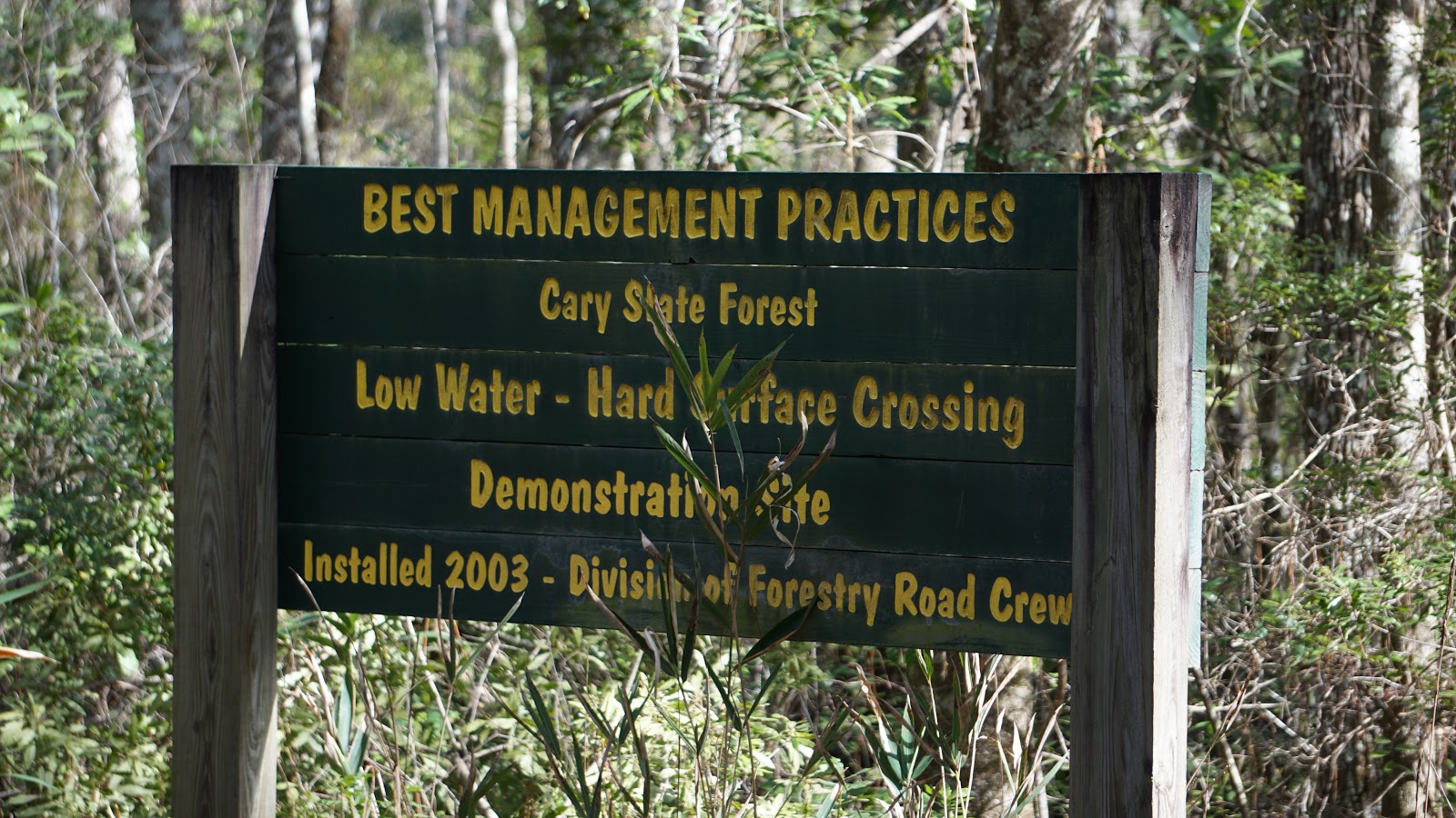
In order to start on the east side of the forest, you need to find the very unassuming entrance at a bend off of Garden St. It wasn't until a Trans-Florida rally last year that I realized this even existed, so I figured I'd make use of it again for this track. Should be easy enough for you to find after looking at the .GPX and dropping a pin on whatever navigation app you are using.

It's not a small sign, but if you aren't paying attention you might miss it!

Adventure awaits!
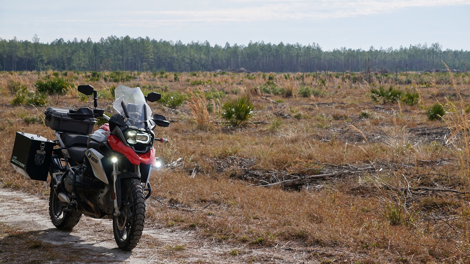
After you find the sign and take your pre-adventure photos, follow the line on your GPS for the first few roads. It seems that the forestry folks are tidying up the road a bit in these parts, which is nice. This should give you some time to get "warmed up" for what's to follow. Following the line through the first two right hand turns will take you to an area that didn't even really feel like Florida to me. There are no trees as it looks like the area is being harvested for who knows what. I would imagine that the sand here would be pretty fine if it was dry. Use caution and good technique here.


The flatness of Florida, accentuated

Keep going until you get to the yellow dot waypoint and where the track turns yellow. I did this for a reason! The small little path here looked easy enough, but it seems as though a creek had flooded its banks and left the area EXTREMELY swampy. If you're on a big bike, you see water, and choose to continue, prepare for that unmounted power-walk. I had to do it myself for about half of this little section. Smaller bikes would have a much easier time I would think, but I could be wrong. Do not fret if you have to turn around and backtrack. There are plenty of other trails to follow to get to the west side.

After you get through the bog (if it's wet) you'll have to pass through a hole in a fence to the right. I did not see any signs that mentioned trespassing or anything so I just went with it. The next few roads/trails seemed much more heavily used and therefore easier to traverse. There were a few hunting blinds and deer feeders here and there, so this was obviously a popular hunting ground. I would hardly call that hunting, though that's just my opinion. As you begin to work your way back west, the road quality diminishes greatly. These are probably primarily used for logging and were basically small flowing rivers at the time. The tannins in the water gave the illusion that it was much deeper than it actually was, which was only a few inches. A little off-putting when you're in an unfamiliar area. Once you get to the power line road things will get a little easier, at least for a little while.

You will encounter many muddy areas like this if you choose to take these trails after it rains. Welcome to Florida!
Power Line road will offer some water holes to pass through as you head south on it. Stay on the main track and don't wander too far off to the side trying to miss the water. The shoulders are VERY soft and you're more likely to get stuck in that than what you see on actual road. Ask me how I know... Resist the urge to drop the hammer down this road too, as there may be a sneaky pothole or slick mud patch that could ruin your day in an instant. Go around the gate you'll eventually come upon and keep following the line to the next caution area.

If I remember correctly, North boundary road, as it's called, had some pretty hellacious water situations going on. First, you'll run into this...


It may not look like much, but this almost came up to my knees.


I stopped to assess the situation and check the depth of the water since the forestry vehicles can be pretty tall. The last thing I needed was for this little pit to drop off into nothingness and I end up sinking my main mode of transportation. Luckily, the entire crossing is gravel and probably didn't exceed a foot and a half. Easy Peezy. Be very careful when going through the water holes as you continue west, though. The right side line I was favoring down the road was working out quite well and I got a little ahead of myself. The track I was on took a nosedive and spooked me quite a bit. It was a "keep the throttle open so water doesn't get into the exhaust" situation. It's never a good sign when you look over your right shoulder and you see a mini-rooster tail of water being ejected from where your exhaust should be. As luck would have it, whatever was on the bottom of that pit was grabby enough for my tires to catch and get me out of what could have otherwise been a disastrous situation. Point to be made: choose your line carefully. I think the left side would have been a little better, but don't quote me on that. I'd like to go and see what this stretch looks like if it ever dries up.

After this little caution area, the rest of the ride is a cake-walk. There are some minor water crossings here and there, but if you stay on the main track you shouldn't get stuck in the mud. Keep following the line until you get to the main facilities. Depending on what time you choose to undertake this ride, you could park the bikes and eat lunch at the nature pavilion if you've brought it with you. There are also campsites available complete with picnic tables and fire pits for those that are looking to stay a little longer. Restrooms are available and maybe showers, too.

Need some information on camping at Cary? This little area has all the info you need. There is also a campground host to answer your questions as well.
I'm not sure what else is in this building, but the little male and female plaques at least tell me there are restrooms.


If you keep following the line out of the forest you'll end up on 301. Head south and it takes you to I-10 where you should be able to find your way home from there. I wish there were more restaurants in the area, but it seems there are only a few gas stations peppered around. One of them does look like it has a small cafe attached to it, but it never appears to be open.

Another unassuming sign on the west side of the forest.
 All in all, it took me two hours to complete this ride of 17 miles. That includes most of the times I got stuck in the mud and forgot to pause the recording as I tried to reverse my stuck-ness. If it was dry, things probably would have progressed much faster. Please remember that larger bikes may have a harder time in some areas, especially the areas highlighted in yellow. As with anything, try to assess whether or not this ride fits your skill set. If you're just beginning adventure riding, I would say this one isn't for you just because of the amount and unpredictability of the water crossings. If it's been dry for a while, maybe give it a go. There will be a more beginner to intermediate ride of Cary that I'll do in the future. Until then, feel free to explore the area and make your own tracks!

Happy riding!

Follow this link to get to dualsportmaps.com and download the .GPX file for this ride.

For more information on Cary State Forest itself, click here.

Saturday, January 26, 2019

Reflections: Going on trips

The first "long" motorcycle trip I ever took was in 2014. It was on a my 2007 SV650 up to the Smoky Mountains of Tennessee and North Carolina. Roughly seven to eight hours from here if traffic is in your favor. The account was extensively documented in previous posts. Reading through those posts now, it reads as a comedy. Of course, this was my first trip outside of jaunts down to Daytona or Orlando, but I was wound up tight about everything. This post will serve as a reflection piece on how my approach to motorcycle trips has changed.

Weather:

I'm fairly certain that I checked the weather every day for where I was going after I booked my hotel. In hindsight, this added a certain level of stress that I probably did not need. Staying informed is one thing, but it seemed as though the more I checked it, I thought it was less likely it would be that foul weather would roll in. This tactic clearly did not work, as it rained for the better part of my "adventure day" and for the entirety of my return trip home. Seeing as I had already purchased a hotel room for a few nights and taken the time off from work, rescheduling would not have been so easy, so I just rolled with it. While this did not take away from my trip, I'm sure the pressure of knowing it was going to happen weighed heavily on me. It should go without saying, but checking the weather every day isn't going to change anything. Mother nature will do whatever she wants and you just have to adjust accordingly, whether it be a reschedule or just dealing with it.

Nowadays, I rarely check the weather aside from the notifications that pop up on my phone from time to time. Living in Florida, things are quite unpredictable and one must be prepared for whatever comes your way. Sometimes you can get lucky and actually see where the rain is coming down and adjust your route accordingly. For trips, I may check it once or twice just to stay informed, but as mentioned before, continuous checks aren't going to change anything. More often than not, I find that not checking the weather at all and just bringing what you need to handle whatever comes your way works quite well. That obviously expands into making sure that you have the proper gear and whatnot. Perhaps a post dedicated specifically for kit will make its way on to here.

Routes:

Google maps was my best friend before I went on that first trip. There were specific roads that I wanted to ride, but I do think I made a fundamental mistake in over-planning. My to and from route was quite strict as I wanted to get up there and back home as quickly as possible. It was mostly highway anyway. The over-planning occurred during my adventure day. I had actually made a route that I was going to follow. No room was left for much deviation. Some people may like that, but after making multiple trips up there, this was the wrong way to do things, in my opinion. Again, staying informed is one thing, but leave the room for deviation. Areas like the Smoky Mountains have side roads all over the place that hide little hidden gems like great food places, dams, waterfalls, and who knows what else.

If you're an adventure rider, exploring the hard top loosely is still the way to go, but when you do happen to take things off the beaten path, I would recommend following a .GPX file. Just upload it and follow the line and you won't get lost. This may sound obvious, but the first few times I went off into the fire roads, the use of preloaded Google maps was how I tried to get around. More often than not, the maps didn't cover the areas I was travelling in. It wasn't until later on that I discovered the magic of the .GPX file and life became much easier. So do research to be prepared, but not too prepared. Sometimes it's not an adventure until you get lost.

Accommodations:

Rather straightforward; determining a place to stay. Street riders would most likely stay at the plethora of resorts, hotels, and airbnb options. Nothing wrong with that, but getting yourself tied down with a reservation could be problematic given unpredictable weather at times. Some places may be more flexible than others with rescheduling, so I would inquire when making the original reservation.

Moto-camping in my opinion is the way to go. Ultimate in flexibility and more often than not, you can find spots that are free. Obviously, they won't have the facilities such as showers and toilets, but if you feel like going full mountain man and bathing in the river and pooping in a hole you've dug yourself, by all means, prepare yourself accordingly. Speaking from experience, that always makes things more exciting.

How things have changed:

Moto-trips are now approached much differently than they were before. What used to be weeks of preparation can now be condensed into a day, give or take. The mountains have become a familiar visiting place for us now, so I will admit that familiarity does go a long way in reducing the amount of planning that goes into trips to that general area. New places do get a little more research and route planning done, but as mentioned before, make it loose. Give yourself the ability to make the detour or get lost a little bit. Who knows what you might find or the people you'll meet. Since you're on a motorcycle, people will generally want to try and talk to you more anyway, it seems. While I did make the mistake of trying to cram too much mileage into each day for my Colorado trip, the otherwise "less is more approach" helped me quite a bit. That particular trip was for a total of 9 days. Time spent planning it was less than a week.

Obviously there are different types of people out there, and some would see this kind of shoot-from-the-hip approach for a motorcycle trip irresponsible. These words are just my opinion, so take them with a grain of salt, as one should with all things. All I hope for is that something in here might help make your life a little easier on the road.

With all that being said, how do YOU handle your motorcycle trips?

Happy riding!

Friday, January 25, 2019

Adventure Series: Imeson Park

If you do not have a motorcycle capable of operating in sand, DO NOT attempt this!

I've been down Zoo Parkway many, many times and all those times I've never seen this. A veritable off road playground for the not so faint at heart about 10-15 minutes from downtown Jacksonville. Just a left off of Zoo Parkway onto Imeson Park Blvd and it's literally right there.

It would be wise to pause before rolling down into the box right away. Things may look deceptively simple, but the sand here is quite loose. There are multiple entry points, some much steeper than others, so choose based on the equipment you're bringing. The .GPX file that can be found at the bottom of this post is essentially a perimeter trek around this "park" and the entry point I chose seemed to be the easiest. There are plenty of side trails here and there, but since I was on a heavy adventure bike with worn Karoo 3s, I chose to stick with what appeared to be the simplest route. The term "simplest" is used loosely.

Take the trail to the back of Imeson to gain access to this area.

Heading north along the left side of the route takes you to a massively open area that has clearly been used for extracurricular purposes by others. The trail there is not boring at all as it has some minor whoops along the way. Tread carefully since you'll still be dealing with loose sand. It had rained a few days prior to this visit, so there was a nice little pond in the center of the open bit.

Continuing to follow the line on the map will take you over to the right side of the park. This is more wooded and a little technical. The trails are tight, the loose sand is still present in addition to whoops again, and there might be animals along the way. I did not see any myself, but I did see tracks for deer, foxes, and even rabbits.


The track here looks well packed, but do not be fooled; it is quite loose
The track I took required me to double back a little on a trail that I had already taken so take care when heading back south. Heading back will bring you to another open play area. This spot has some sandy hills that, when I stood back and looked at them, actually scared me a bit. I applaud the adrenaline junkies that put the tracks seen in those paths. I wouldn't dare try some of those with my GS. If I did, a disaster would be sure to follow shortly after launch. I will admit that I tried one of the seemingly smaller hill tracks, but it spit me off the side in, what seemed to me, spectacular fashion. It was time to go home.

These inclines were probably around 45 degrees. Nuckin Futs.
The sand kickstand is the best kickstand. Unless you dig in too deep...
The route I took to get out seemed to be the easiest for me since I was tired by that point. A couple of rounds were made around the park before turning on tracking in order to figure out how it was going to be done. You'll see the multiple exits, so pick your poison as you see fit.

While it may not be a "point A to point B" adventure ride, it still counts as one in my book. Especially given the lack of decent riding in Jacksonville proper. If anything, use it as a training ground for dealing with loose sand. You will be picking your bike up a lot, especially if you bring a heavy like I did. Just make sure you come prepared and bring lots of water to stay hydrated.

Happy riding!

Click this link to access the .GPX file on dualsportmaps.com for this ride.

Thursday, January 17, 2019

Welcome back: A hiatus too long

It's been four years. Four years where this blog, a point of pride for me back in the day, has been stagnant. Now that it has been rediscovered, a lot of catching up needs to be done. Locations have been moved, motorcycles have come and gone, new technologies have been discovered, and much maturity has been gained.

Let us begin.

The last installment for this blog was February 2015 where a trip that was taken with my wife up to the Smokey Mountains was regaled. A trusty SV650 and an old GS500 were our bikes at the time. While these were wonderful motorcycles, needs change and so does the equipment to fit said needs. The GS500 was sold after we became tired of working on it nearly every weekend for some reason or another. Since my wife and I are heavy motorcycle commuters, that just wouldn't cut it. The capital gained from the sale would go towards a brand new Yamaha FZ-07.


My wife loved this bike. A decent upgrade in displacement and horsepower coupled with fuel injection meant easier commutes and more enjoyable rides. A service plan also helped to take the load off of any heavy maintenance. Dubbed "Maxine," this Yamaha was near and dear to my wife's heart for about 40,000 miles. Until CASE came along. An explanation is to follow.

Jarvis the SV650 was ridden to the point of exhaustion. 104,000 miles were put on that bike. Most maintenance was done by yours truly. Wheel bearings that tried to kill me on my birthday were replaced. A burned out rectifier. Notched steering bearings. Fork seals. Dent repairs. A few batteries and many, many chains. Jarvis was my ride during silly Instagram projects like "#motoselfie365" where I would try to take a selfie with him every day during a ride for a year to inspire other riders that it could be done safely and "#journeyto100k," or something to that extent, where I kept track of how things were going with Jarvis as he made his way to 100,000 miles. He ultimately reached that goal during a trip up the east coast to Times Square in New York City.


Jarvis was sold to a new, eager to learn rider who was trying valiantly to contain his excitement but failing miserably to do so at the same time. All I can hope is that both are still doing well.

TARS the Kawasaki ZZR1200 passed through the garage for almost exactly a year. A gift from my dad, I had to fly up to Maryland to pick him up and ride it back down the Florida starting the next day. The return trip lasted 2 days and we became well acquainted as I took Skyline Drive all the way back down as far as I could the first day. The name TARS came from one of the robots in the movie Interstellar. In the movie, TARS was a bit rowdy and rambunctious, with a knack for exceedingly dry humor. A perfect moniker for a loud, heavy, fat tank that was my ZZR1200.


TARS was an excellent commuter with heated grips, a custom Corbin seat, a smooth inline-4 engine, and hard GIVI cases on the back. The Smoky Mountains were obviously visited a few times, but the highlight trip with TARS was across a large portion of the United States over to Colorado with a stint to Moab, Utah, and back. While this trip was awesome in its own right, it also made me realize that I was lacking capability to see the things I really wanted to see. About a year later, that capability was attained.

Enter CASE the 2016 BMW R1200GS. TARS was traded in for a meager sum as a down payment for this motorcycle. He actually just barely made the cut for trade in. The dealership found a wholesaler that would take him for $1,200 and I rode away on my new-to-me dream bike.


CASE is another robot from Interstellar, but the more quiet, reserved, analytical one. Again; absolutely perfect. Since getting the GS, a newfound love of off road adventure riding has blossomed. This led to learning about all new things like detailed GPS units, understanding what a .GPX file is, navigating with roll charts during rallies, body position when riding in sand, how to approach an unknown water crossing, etc., etc. I think all of the stories that I have told my wife about taking the path less traveled led to her getting a bit jealous that she could not partake in such shenanigans. This, in turn, led to her trading in Maxine for the very first  2019 F750GS in north Florida. Her name is Cooper and she is quite the fun motorcycle.


Now that you have been caught up on the garage, an update about the actual blog is in order. When I first started this, it was a project to keep myself busy during a period of unemployment after college. Routes were described quite dryly with attached screenshots from Google maps of the route itself. Not very fun. It then morphed into an actual blog where I would describe trips that were taken. There will be more on that in following posts. I will stick to the "here's a route, what it's like, and where it is" format, but more effort will be put into each post. Photographs, more personal thoughts, along with .GPX files will be included if I can figure out how to add them in, too. Old routes will be re-ridden and updated as necessary. New routes will mostly be adventure oriented rides, so prepare yourself accordingly if you choose to take one. The overall look has been updated a little bit in order to make it easier to read. I've come to learn that there is a balance between form and function; I think form was focused on too much before.

I am very excited to bring this back to life, if it even had any life at all. So please follow along, subscribe, like, and comment to your heart's content. I hope that this can become a useful resource in discovering new, every day adventures, possibly right in your own backyard!

Friday, February 20, 2015

Mototrip with the Other Half

Since my most recent trip was rather cool, I feel that it should preface the actual upcoming trip. I am currently sick and have nothing else better to do, so I will accelerate the process of sharing this trip with you guys. Someone also requested pictures from my recent October 2014 trip so they will be included in here as well. Images from my older March 2014 trip can be found in my older posts on here.

So without further ado, here we go.

My wife and I live in Jacksonville, FL. If you want a decent road, you will have to road trip it for quite a while before you get to anything interesting. Being that it is Florida, many of the roads here are going to be straight, vast expanses of level ground. As someone so eloquently put it on SVrider.com; "Florida's Tail of the Dragon...11 turns in 318 miles." As sad as it is, I could not agree more with whoever said that. I wanted to test my wife's mettle, so we packed up the bikes and headed up north. It was pretty cold when we left, but nothing we had not dealt with before.  Temperatures might have been in the low 40's when we set off. It warmed up nicely as the sun came up though. Of course there was the obligatory stop at Chikfila for breakfast and coffee. Our check in point was a place called Whitewater Express. We had stayed there on a previous trip and really liked it, so when we saw the groupon for them again, we had to take advantage. It's right on the southern Tennessee/North Carolina border. 


It took us about 8.5 hours to get up there. No problems whatsoever, which is always a good thing. Our stay this time around was going to be very short, so if we wanted to knock out the dragon, we had to do it the same day as the trip up there. That meant humping it 8.5 hours, checking in, unpacking at the cabin, then jumping back on the bikes for another 1.5 hours to get to Deal's Gap. Since my wife was on unfamiliar roads, she took her sweet time and it took us much longer than anticipated to actually reach the dragon. An oversight on my part, I suppose. We finally reach the start of US129 around 6 pm and my wife is already kind of panicky just from the roads to get there. I told her if she could tackle the roads earlier, she would do just fine. Just look through your corners and avoid target fixation at all costs. 

We set off and I realize it is slow going right away. Those that have been on this road know that bikes will literally eat it up and it's super fun to ride on. Since my wife was spooked to begin with, there was no spirited-ness about this jaunt at all. There were a few times where we had to use the pull-offs so CARS could pass us by. I started to get frustrated, which rather kills the mood for both of us. Just before the overlook to the gap we were lucky enough to catch the Killboy photographer as he was packing up. We were the last set of bikes he got shots of before he took off. After getting to the overlook, we get off so my wife can relax a bit and I can be grumpy. She managed to get one of the funniest pictures while we were waiting to get back on the road.


Also, as the trip was short, you can see that our packing set-up was quite light. We were also wearing backpacks for stuff we wanted to keep on our person the whole time. We get back on the dragon headed north so we can finish it out. I take off because I was getting antsy. I reach the end and it's nearly a full five minutes before my wife comes petering down the road. We still have to go back to the cabin for the night and I was hoping we would make it back before the sun went down and it got cold. Maaaaaaannnn was I wrong about that one. Due to everything taking much longer than anticipated, the sun was almost already down by the time we finished 129 going south. My wife wanted to get a picture with the metal dragon they have there at the resort and we were going to get some stickers, but the gift shop had closed maybe 15 minutes before we got there. I will make a note to get her some on this upcoming trip.


Aside from the cold and riding for probably a solid 12-13 hours that first day, I'd say we did pretty stinking well. Both bikes performed admirably and operated without a hitch. The rest of the trip consisted of whitewater rafting on the Ocoee river and paintball on a mountain side. We also made an aside to Nantahala Outdoor Center for dinner one night as well. As always, Killboy knocked our action shots out of the park!!!


The trip back took us a bit longer. We stopped at a gas station after we had gotten out of the mountains in order to do a spot check with maintenance, lube the chains, check oil levels, etc, etc. Since we take very good care of our steeds to begin with, they treated us just as well on this trip. Neither bike needed much of anything aside from a spray of lubricant on the chain. After a quick breakfast and coffee at Dunkin Donuts, we scooted on back to Jacksonville in roughly 9.5 hours.

This next trip will be done all by my lonesome again, but I don't mind the solitude at all. Ever since becoming a teacher, silence and time to myself is something that is hard to come by. I wonder if I will appreciate the upcoming tour more so because of that fact. We shall see!

Thursday, February 19, 2015

Mototrip Round 3: Another Trip to the Mountains

...this time with friends!!!

For those that followed last year, you know I took my first big solo motorcycle trip up to the mountains of North Carolina and Tennessee. I was able to score a pretty decent deal on a fairly nice hotel in Gatlinburg, so I had to take advantage. Due to scheduling the trip in the middle of March, the weather turned out to be quite gloomy. The weekend before it had actually snowed there! On the way up it was absolutely beautiful, but the day I actually romped around and my entire trip back were done entirely in the rain. This lead to some technical problems which lead a 9 hour trip turning into a 12 hour trip. Either way, it was a successful trip and I came back knowing more about my limits and the limits of my bike, Jarvis.

Trip number 2 came in October with my wife. This trip was also extremely cold due to being scheduled later in the year. The trek was originally planned for whitewater rafting but after looking at the map, I noticed our cabin site was not too far off from deals gap. It took little convincing of my wife to agree to take the bikes and make an aside when we got up there. Since it was still "in season", we were excited to get our pictures taken by Killboy and whatever other photographers might be camped out along the famous 129. Now don't get me wrong, I love the fact that my wife rides a motorcycle and I applaud her for attempting the Tail of the Dragon after a VERY long trip up, but let's just say that our passes weren't nearly as spirited as one would expect. The temperature probably played a fairly large role in her behavior. I now know she is not that type of rider and I am completely OK with that, but when a group of bikes is slowing down car traffic where motorcycles should eat up the road, you know something is amiss. It doesn't matter though!!! Her little '92 GS500E handled the trip like a champ and didn't skip a beat the entire time. There was one little scare where she thought she was running out of gas with not an exit in sight, but that was just a one-off. Another successful trip there and back, complete with white-water rafting and paintball!

Enter trip number three. This is being organized by a friend of mine that is local to Jacksonville. He has never been and neither have many guys from our local riding group, so a Facebook group was made and the ball was started rolling on a big trip up north. There are a few guys (maybe 1 other now that I think about it) that have been on these roads, but that was nearly 20 years ago. A lot of things have changed since then. A LOT. Because of the greenhorn status of the majority of the group, I found myself being an invaluable asset to the group, regardless of if I go or not. Because this new trip is scheduled in a nearly identical time frame as my trip last year (this one is the 26-29th), I immediately raised concerns about the weather. Even though was are only just getting through February, I can already say this winter has been extremely bipolar and temper-mental. Warm one day, freezing the next day, rain for a week after that, back to freezing, then maybe a few clear days after that. I would not be surprised if snow was still on the ground again in some areas once we get up there.

Riding skill was another thing that concerned me. Our group consists of competent riders. All have had their spills and hopefully have learned from them. The thing that I do not think will translate well with the others is no matter how skilled they are down here in the flatness of Florida, nothing down here can really prepare you for a REAL mountain road. There are a lot of things you can get away with here in Florida. There really are no hills to negotiate and engine braking is really only for those that  have done their research about it. I can't speak for others in the group, but I have noticed a lot of riders in this state that seem to pull the clutch and coast to a stop before getting their gear position sorted out. Where we are going, engine braking and not riding the brakes is a necessity,as well as looking through your turns, adjusting body position, and staying focused. A plan has been worked out if someone does go down, but hopefully it will not have to be put into action.

We will be staying in Fontana Village. Looking at the map, it appears to be on Moonshiner 28. That means I actually passed this place during my first trip. It probably went unnoticed due to all the freaking rain I was having to deal with. Some will be riding up (such as myself) and others will be trailering. I am actually rather excited about this. It is a solid group of guys and I know we're going to have a lot of fun. The actual duration of the trip will also be extended. We will have 2 days to romp around instead of my usual one that I've had before. That means we can take our time and I can actually slow down and take a look at stuff. Since there will actually be 4 wheeled vehicles present, that also means I won't have to ride EVERYWHERE like I had to before. Let me tell ya, I love my bike and all, but after a long day of riding sometimes you do wish you had a car around when it's time to get some food.

I will update stuff as it comes along for this trip. It will be happening in roughly a month, so there should be plenty of content for me to put out for your reading pleasure. Feel free to take a look at my previous entries and take a gander at my videos from my first trip. My videography was not very good then and I am hoping to make a much better highlight video this time around now that I won't be rushing everywhere.

Thanks for tagging along and feel free to comment or give advice on things you might deem important!