Thursday, March 20, 2014

An Epic Sunday Funday

March 16th

It's raining. A drizzle at first while walking to go eat breakfast at the Donut Friar, but it ended up becoming a steady downpour by the time I left. 

Inside the Donut Friar
I could clearly see those mountains the day before.

I was in a hurry to get on the road because I was really excited and had completely forgot to grab the box of attachments for the cameras before I left. That left me with my helmet mount for the ActionCam only. Bummer, but I still got some good stuff. Headed south on 73/441 for a bit to Old Scenic Highway 73 and Little River Road to the strip that would lead me to Foothills Parkway. I didn't mean to take Little River road, but I'm glad I did. I would have missed some beautiful stuff.


The rain had picked up by now, but I was still able to get some amazing views from the parkway. This photo sums up my views until I got to US129.

Note the soaking wet asphalt.
The parkway takes you straight to US129. I stopped for a little bit next to a huge rock outcropping on Chilowee lake to ring out my gloves and warm up some. For some reason, I got extremely excited during this stop. I was yelling as loud as I could and laughing, not believing that Jarvis and I had actually made it. Aside from a car here or there, things were quite desolate. I had not seen another motorcycle since I-95. Despite the rain, cold and general removal from everything, I was unbelievably happy at that moment. 


Putting things into perspective...
I thought there would be more signs indicating when the Tail of the Dragon actually started, so I didn't realize that I was on it until I had the first few curves under my belt. 

"Hey, you're about to be on The Dragon"
Stopped, fired up the ActionCam, and filmed my first, very wet, run on the Dragon. It was loads of fun even with the rain. Before I knew it the Deal's Gap resort was in front of me. I pulled aside so I could dry off and buy some tokens of my completion of this famed road. A small truck had pulled over to let me pass during my run, and it had also come into the resort. The old couple that was in it walked up to speak with me, the lady starting off the conversation with "You're a true die-hard!!!". Continued to tell them that I was up from Florida and it was actually my very first time on the road. 


Awwww yeahhh!!! Nothing to donate!
Needless to say, they were impressed. Hung out in the maintenance bays to dry off a little more and congratulate myself on not having anything to donate to the famed tree of shame. So I buy a hat and some stickers, chat with the employees that were working for a bit on where I should go next, then got back on the road headed for the Cherohala Skyway.

Honestly, I couldn't really tell you much about the North Carolina side of the Skyway because I COULDN'T SEE A DAMN THING. It was covered in clouds and I could barely see more than 30 feet in front of me. At first it wasn't that bad, but as soon as the climb started, man did things turn sour. Prior to riding into the clouds, I was actually admiring how cool they looked crawling down the mountainside. Little did I know that for the next 45 minutes Jarvis and I would be going 30 mph up this winding road. A small break allowed me to assess the full gravity of my situation... 

Where I just came from...
Where I was going...
I passed the highest point of the road at 5,377 feet but didn't bother to take a picture of the sign because I was just too damn cold. Shortly after, something wonderful happened. THE SUN CAME OUT!!! Never thought that something so simple would bring me so much joy. I stopped at the first pull off I found, parked the bike and spread out on the ground to stretch and warm up. If you ever get the chance to ride through a cloud at the top of a mountain, I would suggest that you pass up the opportunity. The down hill back into Tennessee was beautiful and made for some spectacular views. I tried to stop for pictures as often as I could, but by this time I was so cold and hungry that I wanted to get to Tellico Plains as quickly as possible. 

"Sunshine yes! Sunshine yes!"
Winding through the valleys was uber fun and I did actually have to brake for wildlife once as I came through a turn. A fairly large buck decided to plant himself in my line, but took off before he could cause me any more trouble. Arrived at Tellico Plains around 2:00 and ate at the TelliCafe and conversed with some wonderfully hospitable people. The old lady who ran the place kept wanting to feed me coffee and place my gloves over the oven to get them warm and dry. That beats Jacksonville "hospitality" any day.

During my research before the trip and speaking with the Deal's Gap employee, I added "Moonshiner 28" to the list of roads I wanted to complete, but I had to go a round-about way to get back there since there was no way I was going to head back over the skyway considering what I had just dealt with. Went up 68 to whatever the main road is it runs into to 72 then US129. Did the Dragon again in order to get to 28 and noticed that it was drying up. Made a note to come back this way in order to do it one more time going north. 


Just one of a thousand waterfalls I passed.
Fontana Dam
28 was more relaxed a very pretty. Civilization was so far and few between that I could essentially stop in the middle of the road to take pictures and rest, as shown in the waterfall picture above. Made a stop at Fontana Dam to take some pictures and continued on my way. Went up and over some more mountains and through more clouds to get to Robbinsville, gas up and head north on 129. Cell coverage was nil in these areas and GPS on my phone was generally unavailable, so I actually had to use a paper map to figure out where the hell I was. Filmed a fast, third and final run on the Dragon. It started out wet, but dried up nicely afterwards. Went on to take Foothills Parkway back to Gatlinburg. Because it was raining that morning, I missed a lot of the views offered by the pull-offs. Because it cleared up for the most part, I was able to catch most of them on the way back. Same goes with Little River Road and Scenic 13. A pretty epic selfie was taken before I got back to the hotel.


Am I doin' it right?
You may be wondering why my hands are blue in the photo above. Through my browsing of forums, I read that wearing a pair of latex or nitrile gloves under your liners and gloves helps keep your hands warm and dry. Riding a motorcycle with hands that are wet and cold is not safe at all. This was put to the test when riding Cherohala. It did work for the most part, but there was just too much water to keep things completely dry. They never got too cold though, which made me extremely happy.

 Altogether, Jarvis and I probably scooted around the mountains for a good 300 miles that day. I tested my mettle and riding skills on many unfamiliar roads in less than favorable conditions (sometimes much less than favorable) without incident. A sigh of relief was exhaled when I did get back to the hotel. All in all, I was happy, Jarvis was happy, and everything was right in the world.

**If you're wondering where the videos are, they are still in post production so I can make them nice and pretty for you. They will have a dedicated post in a few days.**

Tuesday, March 18, 2014

Brake First, Ask Questions Later

The trip was a success. I made it back in one piece and so did the bike. Despite the weather's best efforts to bring me down, it didn't happen. I was able to do all of the roads that were originally slated on my ride plan and make it back to the hotel before dark both days I was in Gatlinburg. Because each day was so eventful, they warrant their own posts delivered over a few days. That will make things more manageable for everyone involved. These will be photo heavy with each shot preceded by a narrative. The post trip montage will follow after all the updates. So get comfortable and let's start from the top.

March 15th

With everything mostly packed the night before, getting ready that morning was rather easy. All that had to be done was pack a few more cords, eat breakfast, get geared up, say my goodbyes and get under way. It seemed like Jacksonville didn't want to let me go because there was a rather large crash blocking three lanes on 95 near downtown. It was 6 in the morning and people still managed to find ways to smash into each other when no one else seems to be around. Passed that and opened it up, preparing for the long haul.

Two hours and 110-120 miles in and the bike cuts out. WHAT. THE. HELL. I begin to pull over, but Jarvis turns back on. There is a noticeable lack in power and I'm getting the "FI" light and rotating "CHEC" on my instrument cluster. I'm still running, so I decide to try and ride it out. Until it happens again! He cut off for a little longer the second time, so that instigated finding a gas station to figure out what the hell was going on. I'm not really panicked but rather extremely pissed off. I pull apart what I can in the parking lot of the gas station I was at with the stock tool kit, with people looking on in confusion. I checked battery connections, made sure the spark plug boots were seated properly and that the plugs were actually tight, scraping up my knuckles on radiator fins in the process. Thought the tank vent might be blocked or clogged due to the heavier than usual tank bag, so I removed the bag, opened the gas cap and cranked him up. He ran fine for a minute, then the idle dropped again and up flickered there error signs. Damnit. Something has to be fouling up the fuel pump in one way or another. After a distressed call to the fiancee' and some deliberation that I should call off the trip and turn around, it was decided that I should fill up, add some fuel system cleaner, and push on. Jarvis ran strong after that with no hick-ups for the next 6-7 hours. I'll chalk this scare up to bad gas that I filled up with at the Gate station the night before.

After navigating around an accident on 95 that had people hanging out outside of their cars, I kept going until I hit 26 west that cuts across South Carolina. Heading further inland, the road became more and more hilly. It was fun, but was killing my miles per gallon. Stayed on 26 until Highway 40 in NC. It wasn't that long before I started seeing mountains in the distance and I couldn't help but hoot and holler at the sight of them. 


I was getting close to my destination. 40 was super fun! An excellently paved road carved through the mountains along the Pigeon River. I don't think the Pilot Road 4's that Jarvis wears have ever actually been "warm" in Florida, but they sure were blazing down 40. 

I wanted to do an actual mountain road before I got to the hotel. I made a lot of rest stops along the way up and amazingly wasn't really that tired. Pulled off on Waterville Road to take 32 West shortly after passing into Tennessee. 


Researching this road on Google Maps left me with some questions as to whether or not it was fully paved. It wasn't, but only for a short portion. Still fun though and I was able to get my dual-sport on for a bit. When the road became paved again it started to get twisty to the point of epic proportions. I quickly learned that I needed to adhere to getting all of my braking done before entering a corner, else I would be shunted off down the side of a mountain. Brake first, ask questions later, you know. I had my fiancee on the phone via a Sena headset so I wouldn't have to worry about calling someone if something detrimental happened to me. Completed that little filament of hell with a smile on my face, giggling all the way.

Whoever thought it would be a good idea to have a Shriner's parade on the main drag of Gatlinburg needs to rethink what they are doing with their life. I got there around 3:45 and didn't get to the hotel until AFTER 5. Officers were redirecting huge amounts of traffic onto tiny back roads. In my opinion, it wasn't really that well thought out. The temperature had also risen to an uncomfortable level with all my layers and gear on and I was sweating up a storm while stuck in all the traffic. 

I had already decided that Saturday night would be spent back on the bike heading south on 73/441 towards Cherokee for dinner after checking in. 


This was a beautiful road! The weather was nice, although it did get pretty chilly as the elevation rose. I had stripped a few layers off before leaving the hotel since they were soaked with sweat and I was somewhat unprepared for the trip back because it got so cold. For some reason I decided to leave my overpants in the hotel room. Getting to Cherokee was interesting. There was a Toyota Camry in front of me that I decided to pace myself with since I was on an unfamiliar road and was under the impression that the speed limit would at least be heeded. Boy was I wrong. This dude was hauling ass! I did try to keep up, but stayed a little slower because I wanted to get some good shots with the ActionCam and there was a lot of salt residue on the road. Snow was everywhere once we got pretty high. Finally get to Cherokee and NOTHING is open because the season for them hasn't started yet. Awesome. I originally planned on getting there, eating dinner, and getting back on the road before the sun went down. One of my highest priorities was to stay off of the roads after dark because I knew nothing about them. Since nothing was really open, I turned around and headed back the way I came, stopping here and there to snap some pictures.


Ended up walking around a little and eating in Gatlinburg. Got back to the hotel room to transfer all the video and pictures, made sure all the cameras were charged, and got some much needed rest for the following day.

Friday, March 14, 2014

We are in the green.

It's that time. The weather has been holding out well enough where I didn't feel the need to cancel, so the trip is a green light. Here is what I'm looking at now. Hoping that the rain will be mostly during the evening Sunday night and run through Monday morning. It's predicted at only half an inch of rainfall, but that half an inch can makes things extremely slick.


  An epic theme song has been chosen and the bike is as ready as it will ever be. All maintenance has been done; oil and brakes checked, chain cleaned, lubed, adjusted to spec, and every piece of luggage stuffed with the necessities. To be honest, the camera stuff is taking up a lot of room that could be used for more clothes or something, but that's not really needed since it still is an extremely short trip.

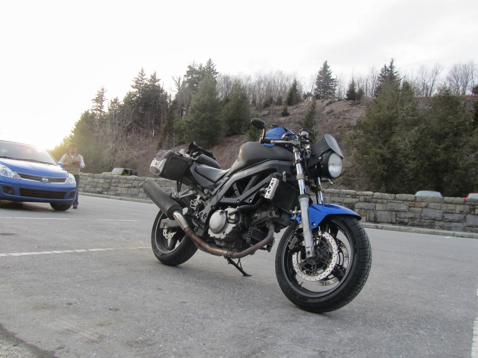
Here is Jarvis, in all his sport-touring glory.


After quite a bit of deliberation, I decided to forgo the backpack. 8-9 hours is a long time, and it would be even longer carrying that thing around. All of the cameras and attachments are more easily accessed, as well. If they were in the pack I would have to stop, take it off, search for what I need, set it up, then put everything back on. It will be much easier with everything right in front of me, for the most part. Plus, it would be just something else to keep track of.

In preparation for tomorrow, I didn't get in my full workout today as usual. It was kept at a fast 2 mile run with my dog. The reasons for this are as follows... First, I would rather not be sore before departing. I'm going to be sore enough as it is when I get back, so I would like to be as comfortable and limber as possible initially. Second, if I don't work out I simply can't sleep very well. A little exertion tonight will hopefully calm me down from my already jazzed state, allowing me to get some much needed rest. I have also been stretching more often than usual in hopes it will aid me in the comfort department.

Nearly every trip or ride report I've read up on recommends leaving early in the morning, so that's what will happen. I'm shooting for 5:45-6 am. That will give me a head start on any traffic that might build up and at least put me past Savannah shortly after the Sun rises. Getting by there early would be great since it's St. Patrick's Day weekend. The trip back on Monday should be even more interesting, since it will actually be said holiday.

Updates will be posted here and there, with a post-trip report afterwards. I would imagine the majority of motorcyclists would be heading south to Daytona for the final weekend of Bike Week. I choose to head the opposite direction into the maw of an all new adventure. That makes this trip sound way cooler that it probably is....

Wish me luck.

Time to get my money's worth out of this crampbuster.

Friday, March 7, 2014

Hoping for Fair Weather and Packing Options

So we're about a week out from my day of departure. It's been quite a roller coaster with the weather here in Jacksonville and it kind of has me nervous for next week. Accuweather has had a lot of traffic coming from me lately since I've been looking into Gatlinburg's extended forecast pretty much every day. Although those things seem to be accurate about 0% of the time, I hold on the opinion that it is actually letting me know what I could be in for. As of late, snow appears here and there on the days the trip is supposed to happen. Since I have absolutely no experience with riding in snow, the trip will probably have to be cancelled if snowfall does occur. This would devastate me, but that's what I get for scheduling a northward trip so soon into the year. Here is what I'm looking at is very moment.


I think I've gone over the list of things I would like to take on the trip about a million times. First and foremost, my cameras (Sony ActionCam, a "GearPro", and my fiancee's point and shoot) and computer will be coming along, including the mess of cables that will be needed to keep everything charged. The cameras will either be attached to me or the bike so they will never really be in the way or take up much space. All needed attachments will be stowed in a box in a saddlebag. Bringing along a few snacks and water for gas stops is also quite important. The only time I will really be stopping stopping will be for lunch, so these snackies will save me some time and money. I now have a travel sized can of chain lube and will be getting a quart of oil to bring along as well. I've found that longer trips don't really consume that much oil on the SV, but it doesn't hurt to be prepared.


I reality, I only really need to bring a day and a half worth of clothes. Impressing someone is not at the top of my list of things to do during this trip and I think my fiancee will be happy enough to see me when I get back that she would deal with my stank. Staying comfortable and warm is at the top of the list and I will be dressed accordingly. The necessary extras will be packed away nicely and anything larger like liners or sweaters will be bungeed down when not being worn. The same goes for rain pants, but I think I'm just going to wear them from the start to save time. Three pairs of gloves will be making this trip with me. A smaller, full gauntlet style in case the weather permits; a thick winter style glove that will probably be toast due to old age after this trip; a medium thickness "rain" glove with a convenient squeegee on each thumb. I'd like to keep my options open in this department, obviously.


All of this stuff will be able to fit in my current luggage set-up (Cortech tank and tail bag and soft BILT saddlebags). I've already done a dry run just to confirm so there are now surprises when the day comes. The question that I have been rolling around lately is whether or not to bring my backpack to keep more valuable things on my person. Cameras will be removed each time I stop and put into my tank bag, which is magnetic. I usually take that off and carry it like a lunch box whenever I stop anyway. The P.a.S., my laptop, and the cords would be put in said backpack if I were to bring it. Otherwise, everything would find a home in either the tail or saddlebags. My fiancee thinks I should keep my back free since it is such a long trip, which is a valid argument. But keeping these things close to me at all times sounds beneficial as well since I've read and heard too many stories here people get their jollies off by stealing things from traveling motorcycles.


I am also in need of a theme song for this trip! It will most likely be enjoyed by my ears a few times on the way up and used in the inevitably cheesy trip video that will be composed post-trek. Thoughts and recommendations are appreciated!


Now....more waiting....

Wednesday, February 26, 2014

Countdown to Gatlinburg: A Florida Boy Heads to the Mountains

It's happening. March 15th-17th. The mountain ride expedition. Something that I've read up on every day to increase theoretical riding techniques for when I actually get there. The trip that has only been a thought for the past 2 years. The dates were kind of forced on me due to the availability of the hotel, but it's far enough into the year where weather shouldn't be to bad and soon enough to not interfere with coaching spring flag football. This will be my solo vacation to clear my head before the swathe of events planned for this spring and summer (coaching, wedding, honeymoon, etc.) begin to take hold. To make things a little more interesting, I've decided to keep track of my thoughts and happenings, before, during, and after this event on here for your reading pleasure. Funny how a steal of a deal on Groupon can get the wheels turning on things.


So there it is. 530-something miles one way. This will easily be over 1500 miles round trip. Something the mighty SV, Jarvis, will handle quite well I believe. It's going to be quite the haul, especially for one day. Since I will only have 3 days to make it up, have fun, then come back, the trips to and from Gatlinburg will have to be knocked out as quickly as possible. March 15th will be departure day with plans on getting to the hotel around 3 or 4. I've altered the route there a smidge so I can negotiate my first serious mountain road right before I get to my destination. I've kept it open to take the original route around said mountain if I'm too weary from the trip up, which is a definite possibility. Although I'm young and resilient, I may have to utilize my better judgement for this bit. My return date will be the 17th.


Here is my endgame. A collection of roads well known in motorcycle lore. I plan on making my way over to Deal's Gap, better known to some as "The Tail of the Dragon", the Cherohala Skyway, as well as any other roads that tickle my fancy on what I hope will be a fantastic Sunday the 16th. I'm keeping my fingers crossed that the shoddy weather that's has been crapping all over the southeast will take a break so I can actually enjoy the trip. I don't care if it rains on the way there or the way back. Just let that Sunday be sunny and dry. Since this is my first BIG trip, I'm going to attempt video-documenting with multiple cameras. Not only will this give me something to look back on in the future, but it will keep me occupied en route.

Since I will be by myself...
On a motorcycle...
For 9 hours...

The reward will be well worth it.

The planning stages have already been completed much earlier than anticipated, aside from some last minute maintenance that will have to be done right before I leave. New or replacement parts that were necessary have already been bought and installed, spark plugs have been replaced and air filter cleaned. Everything will be gone over with a fine tooth comb the night before embarking on this ultimate super-slab session. The excessive highway does not bother me. That's what podcasts and music are for. The only "concern" that I have will be how this Florida boy, whose largest grade change was encountered going over railroad tracks, will handle switch back turns integrated into 3 story elevation changes.

Engine braking will be a must.

Sunday, December 30, 2012

To Nahunta and Back


This one was probably the longest ride that I've done in a while that has been noteworthy enough to include here on the blog. Altogether, I think I put in about three hours of seat time from start to finish. I enjoyed it quite a bit, although the wind could have cooled its jets this weekend. My neck and shoulders got quite the workout on the way up. This one gets a little rangy, but if you have a free day and some nice weather to work with I highly recommend it.

The easiest starting point that I've found for this ride is from I-295. Head around whichever way would be fastest for you to get to New Kings Rd north and get off there. This section is rather straightforward since you're still pretty close to downtown Jacksonville. There are a few gas stations to fill up at (which I would highly recommend doing if you haven't already done so) and some fast food joints if you need some sustenance. Continue going north to Callahan, but stay your course, as New Kings Rd will turn into 301/1/23. I'm most familiar with 301 so I just followed those signs. After Callahan you will hit Hilliard. I think  it was here I passed a pit BBQ joint that smelled so good that I nearly turned around to check it out. Small red building on the left that will probably be billowing delicious BBQ smoke. I'll probably head back up there at some point to try it myself.

After Hilliard comes the FL/GA state line at the St Mary's River, then Folkston. Stay diligent through here as the speed limit is rather slow and I saw a few police officers doing the all-too-cliche "let me hide behind this billboard" move. You also need to keep an eye out for the right turn needed to continue the ride as well. I missed it the first time, but hopefully you won't. I believe it was the third light at Love Rd (there is a Walgreen's type store on its northeast corner). Take your right then veer left onto Burntfoot Rd. It's pretty slow through here, but it won't be much longer until we're at the good stuff. Speed up a little bit after you're through the residential area and eventually you'll pass a correctional facility that smells terrible on your right. Shortly after your going to arrive at a fork in the road. We want to take the left fork onto River (Riverside) Rd. You can see the where the fork is better in the upper right hand corner of the zoomed in picture that I provided. The fork won't sneak up on you either unless you're totally not paying attention to what's going on. I believe there is a medium sized church sign or something marking where the fork is, and you can see it from a ways off.

After the left onto River Rd., this probably one of the funnest roads I've ridden in a while. I would have smiled more had my frown from the exceedingly chilly weather not been frozen to my face. There are plenty of curves to keep anyone busy, but the majority of them are blind so I wouldn't push my luck through any. The lack of substantial shoulder plus the not-so-great road quality will keep you on your toes as well. It road reminded me of the kind that would hurt my feet if I walked on it barefoot. Enjoy it as it will dead end back into 301. There should be a gas station in front of you at the intersection, just for a landmark's sake. Take a right and you'll get to Nahunta soon enough. There isn't a whole lot going on out there, but I had originally planned to eat at Jerry J's that's to the right off Cleveland St. Instead, Jerry J's added insult to injury with it being cold by being closed on a Sunday.... My bad I suppose, but at least the ride was good.

Getting back is quite simple. You can either take 301 all the way back down to Jacksonville or do the reverse of the ride just taken. I recommend the reverse ride since taking 301 all the way back is mind-knumbingly boring. Ask me how I know.

Google maps puts this ride as 62.3 miles as marked on the map here and will take 1 hour 24 minutes. If you choose to keep up with traffic though it will probably be closer to an hour.

A deem this ride a 4 out of 5 as it provides good scenery, plenty of places to eat, an extremely fun back-country road, and pleasant Georgia folk that get snarky with you when you don't know where the restroom is in their gas station. Look forward to another longer distance ride for the upcoming entry. Keep the shiny side up ladies and gentlemen!

Friday, November 30, 2012

The County Road 13 Ride: Updated


Hey there everyone! Life has been rather busy again (for a while now) and recreational riding has been at a minimum. I've covered a few new ones here and there, but most of the "fun" riding has been going over old rides with my fiancee' while she's on her new-to-her GS500E. So without further ado, here is the latest installation!

The County Road 13 ride is an extension of the San Jose ride. If you're coming from the north on San Jose, head down to where SR16 intersects with it. This is where we will start our ride today. Simply enough, we are going to stay on this road for the duration.

For the first part of this ride you will enjoy some nice scenery, but you will also have to deal with local traffic taking the back way to St Augustine. Traffic will split of on the rest of 16 soon enough, so you won't have to negotiate it for too long. After you go through the light where 16 and 13 meet, you can now relax and take it all in. Shortly after the light, the world famous Outback Crab Shack will be on your right. Get comfortable now, because it will be nothing but residences on either side for the rest of the ride. There are some nice curves throughout, but I can not emphasize enough how ROUGH this road is. I do not recommend speeding through this one, but rather taking it easy and pacing yourself with the speed limit. Roots and old roads are abound, so keep an eye out and enjoy the beautiful houses, tree cover, and views of the river. Our ride will end when 13 dead ends into 207. Take a left and you start heading towards the southern reaches of St Augustine. Head right and 207 will take you to to Palatka.

From point A to point B, this ride last for approximately 45 minutes and all of about 26 miles.

I'd give this one a 4 out of 5 twists of the throttle. The scenery is beautiful and the road is nice and twisty, but traffic at the beginning of the trip can be a little overwhelming.

Update: The rough portions of this road have been repaved and it is glorious. Nice and smooth throughout. Also, Outback Crab Shack is no longer there after a hurricane caused the river to rise enough to essentially destroy it. The .GPX file starts a little farther up the road at Woodpeckers BBQ. It's a perfect place to grab some grub before or after this ride. Enjoy!

Follow this link to dualsportmaps.com for the downloadable .GPX file.